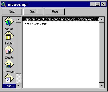
' Name: View.CalculateFeatureGeometry
'
' Title: Calculates feature geometry values
'
' Topics: GeoData
'
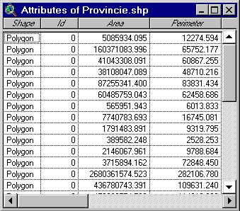
' Description: Calculates area and perimeter for polygon themes
and length
' for line themes. If the View has been projected the calculations
are in
' projected meters. Otherwise the calculations are in 'native' map
units.
' Modify the script to provide calculation in the current report units
of
' the View. The script processes the list of active themes to calculate
' area and perimeter, or length, depending on the theme type.
'
' The script will add the fields: Area and Perimeter to polygon themes,
Length
' to line themes if they do not exist. If the fields exist their values
will
' be recalculated. Rerun the script if you change the projection of
the view.
'
' Requires: A View with at least one active theme. You
must have write access
' to the active theme(s).
'
' Self:
'
' Returns:
'
' Get the view and it's projection if any.
'
theView = av.GetActiveDoc
thePrj = theView.GetProjection
if (thePrj.IsNull) then
hasPrj = false
else
hasPrj = true
end
'
' Get the list of active themes. if there aren't any, let the user
know
' and exit.
'
theActivethemeList = theView.GetActivethemes
if (theActivethemeList.Count = 0) then
MsgBox.Error("No active themes.","")
Exit
end
'
' Loop through the list of active themes. if you can't edit the theme
' inform the user.
'
For Each thetheme in theActivethemeList
theFTab = thetheme.GetFTab
if (theFTab.CanEdit.Not) then
MsgBox.Info("Cannot edit table for theme:"++thetheme.AsString,"")
Continue
end
'
' Make the FTAB editable, and find out which type of feature
it is.
'
theFTab.SetEditable(TRUE)
theType = theFTab.FindField("shape").GetType
if (theType = #FIELD_SHAPEPOLY) then
'
' if it's polygonal check for the existence of the
fields "Area" and
' Perimeter. if they do not exist, create them.
'
if (theFTab.FindField("Area") = nil) then
theAreaField = Field.Make("Area",#FIELD_DOUBLE,16,3)
theFTab.AddFields({theAreaField})
else
ok = MsgBox.YesNo("Update Area?", "Calculate",
true)
if (ok.Not) then
continue
end
theAreaField = theFTab.FindField("Area")
end
if (theFTab.FindField("Perimeter") = nil) then
thePerimeterField = Field.Make("Perimeter",#FIELD_DOUBLE,16,3)
theFTab.AddFields({thePerimeterField})
else
ok = MsgBox.YesNo("Update Perimeter?",
"Calculate", true)
if (ok.Not) then
continue
end
thePerimeterField = theFTab.FindField("Perimeter")
end
'
' Loop through the FTAB and find the projected area
and perimeter of each
' shape and set the field values appropriately.
'
theShape = theFTab.ReturnValue(theFTab.FindField("shape"),0)
For Each rec in theFTab
theFTab.QueryShape(rec,thePrj,theShape)
theArea = theShape.ReturnArea
thePerimeter = theShape.ReturnLength
theFTab.SetValue(theAreaField,rec,theArea)
theFTab.SetValue(thePerimeterField,rec,thePerimeter)
end
elseif (theType = #FIELD_SHAPELINE) then
'
' if the data source is linear, check for the existence
of the
' field "Length". if it doesn't exist, create it.
'
if (theFTab.FindField("Length") = nil) then
theLengthField = Field.Make("Length",#FIELD_DOUBLE,16,3)
theFTab.AddFields({theLengthField})
else
ok = MsgBox.YesNo("Update Length?",
"Calculate", true)
if (ok.Not) then
continue
end
theLengthField = theFTab.FindField("Length")
end
'
' Loop through the FTAB and find the projected length
of each shape and set
' the field values appropriately.
'
theShape = theFTab.ReturnValue(theFTab.FindField("shape"),0)
For Each rec in theFTab
theFTab.QueryShape(rec,thePrj,theShape)
theLength = theShape.ReturnLength
theFTab.SetValue(theLengthField,rec,theLength)
end
end
theFTab.SetEditable(FALSE)
end
|